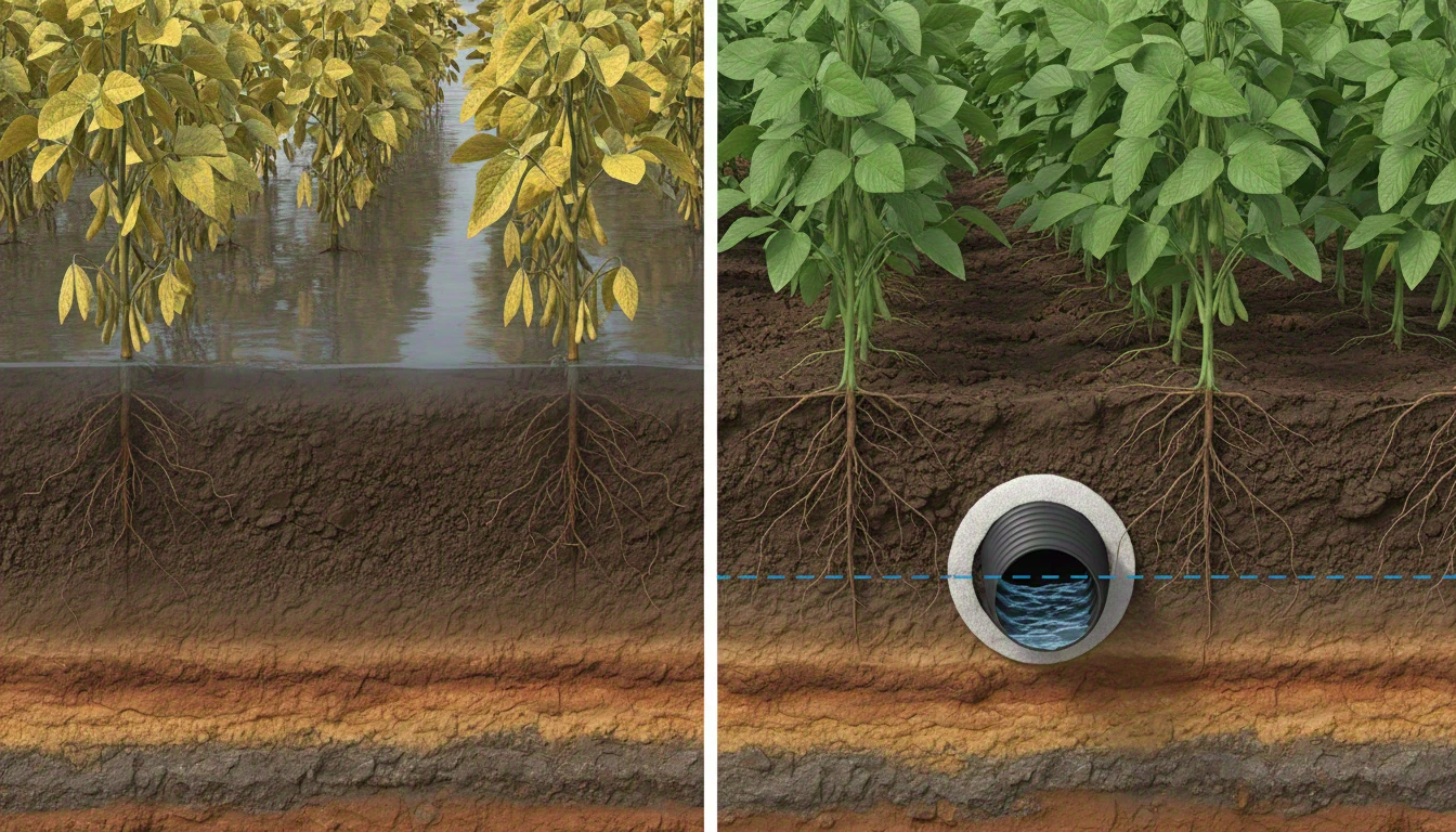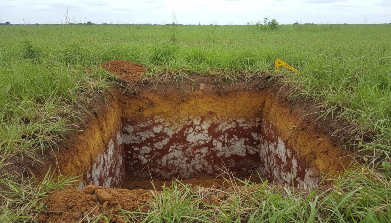


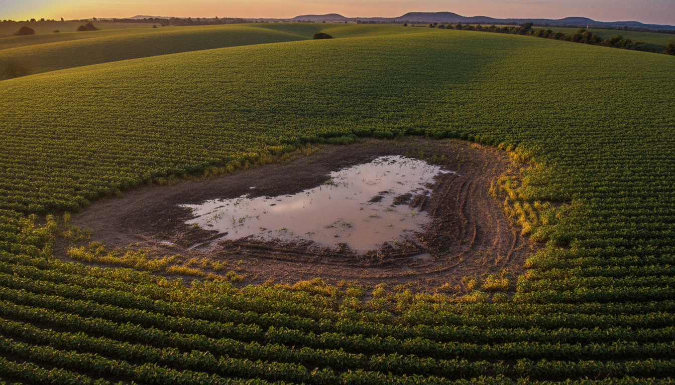
The plot is on high ground, far from any low-lying area. Even so, after heavy rain, a waterlogged patch appears right in the middle of the area — with no apparent logic to someone looking only at the terrain. The explanation isn't on the surface, and it's not the water table — which can be much deeper here. It's in a more compacted soil layer, a few centimeters below, that holds water before it can drain down. This is the so-called perched water table, and it deceives even those who have been draining for years.
What is a perched water table
A perched water table is a layer of water that accumulates above a low-permeability barrier within the soil profile — without being connected to the actual water table, which may be much deeper. Rainwater seeps down, encounters this denser layer, and stops without being able to continue its path. The result is a “pocket” of standing water a few centimeters from the surface, even on ground that is not low-lying.
This is why two neighboring plots, on the same terrain, can behave completely differently after rain: one drains normally, the other holds water for days. The difference isn’t what you see from above — it’s in the soil profile structure.
Why Ultisols are the main culprits in Brazil
Ultisols are the second most common soil class in the country — covering about 24% of the national territory, second only to Oxisols, according to Embrapa. Their hallmark is the textural B horizon (Bt): a more clayey layer at depth, with a pronounced textural contrast compared to the surface horizon, which is usually more sandy.
This contrast is precisely the problem. When the textural difference between layers is strong, water infiltrates quickly into the upper layer and abruptly slows down upon reaching the compacted clay below. Embrapa describes this effect as a former of perched water tables — and in more extreme cases, the accumulation of water at this interface can even favor tunnel erosion (piping) and gullies, because the water starts to flow laterally within the profile instead of downwards.
Plinthosols: when the barrier is even tougher
In some regions, the impediment is even more severe: Plinthosols, with their plinthite layer — an iron and aluminum-rich mixture that hardens with cycles of drying and wetting. According to Embrapa, the presence of plinthite at depth “can constitute a strong impediment to drainage,” and Plinthosols usually occur precisely in areas subject to water table fluctuation or periodic flooding — even when the surrounding landscape is not an obvious low-lying area.
Plinthite is relatively soft when the soil is wet — it can be cut with a shovel — but hardens like a rock when dry. This cyclical behavior makes the layer a self-reinforcing barrier year after year, at the same pace as the rains.
How to identify before investing wrongly
Surface diagnosis is misleading when the problem lies underground. Some signs help raise suspicion before digging an inspection pit:
- Localized and recurring waterlogging on ground that is not known to be low-lying — always in the same area of the plot, year after year.
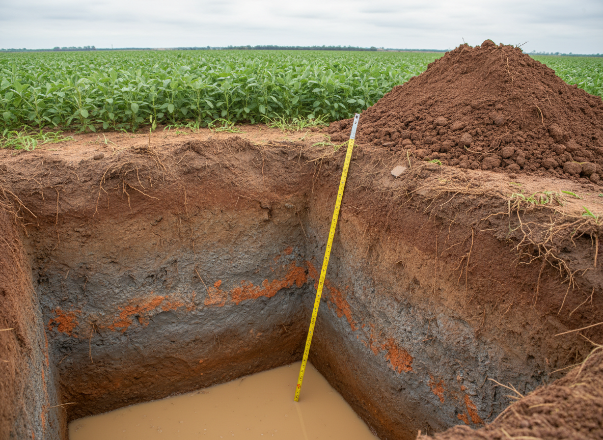
- Abrupt change in texture when digging a pit: a clearly sandier layer on top, and a denser, clayey/mottled layer just below.
- Mottled or grayish color at the transition between layers — a sign of gleying, indicating that this zone is frequently saturated.
- Shallow and concentrated roots in the upper layer, unable to penetrate the denser barrier.
None of these signs appear by just looking at the topography. The profile must be opened.
What this changes in the drainage design
When the cause is an impeding layer in the subsoil, the installation depth of the drain must be defined based on where this barrier is located — not on a generic rule of “digging deeper is always better.” Installing above the layer does not solve the water retention; installing exactly at the right interface captures the water before it accumulates. This is a design decision that depends on the actual soil profile in each area, determined in the field.
For drainage pipes in soils with this characteristic, the Techdreno line — including the KC variant, with self-cleaning micro-slots — is sized by Techduto’s engineering team based on the profile diagnosis of each plot, not on a standard depth.
The first step
If an area of your plot repeatedly waterlogs, even though it is on high ground, it is worth digging an inspection pit before any design decision — it is the cheapest way to confirm if there is an impeding layer and where it is located. The Drainage Glossary has complete definitions of gleying, plinthite, and textural B horizon. If you want to understand other signs that your crop may need drainage, the article 7 signs that your crop needs drainage is a good next step, and the 4-question diagnosis points the way — Techduto’s engineering team then comes in to size the right project for your area.